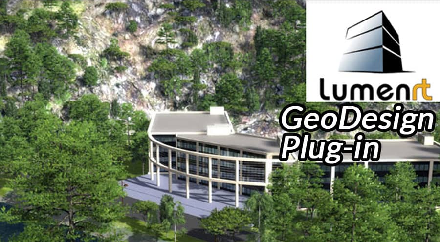
In the realm of urban planning and architectural design, visualizing complex 3D models in a realistic environment is crucial for effective communication and decision-making. The SketchUp LumenRT 4 GeoDesign Plug-in is an innovative tool that bridges the gap between design and visualization, offering designers, architects, and planners an advanced platform to create immersive, lifelike renderings.
What is SketchUp LumenRT 4 GeoDesign Plug-in?
SketchUp LumenRT 4 GeoDesign Plug-in is an extension for SketchUp, a widely-used 3D modeling software. Developed by e-on software, LumenRT is renowned for its real-time rendering capabilities, allowing users to create photorealistic visualizations. The GeoDesign aspect integrates geographic information system (GIS) data, enabling the creation of contextually accurate and dynamic 3D environments.
Key Features
- Real-time Rendering: LumenRT offers real-time rendering, which means changes in the model are instantly reflected in the visualization. This feature is essential for iterative design processes, allowing immediate feedback and adjustments.
- Photorealistic Visuals: With advanced lighting, shading, and texture options, the plug-in produces highly realistic images and animations. This level of detail helps stakeholders better understand and appreciate the proposed designs.
- Dynamic Environment Creation: Users can simulate natural elements like weather, time of day, and seasonal changes, enhancing the realism of the scene. This is particularly useful for urban planners to visualize how their designs will interact with the environment over time.
- Integration with GIS Data: The GeoDesign aspect allows for the incorporation of GIS data, ensuring that models are geographically accurate. This integration is critical for large-scale urban planning projects where spatial accuracy is paramount.
- Interactive Presentations: LumenRT enables the creation of interactive presentations where users can navigate through the model, explore different viewpoints, and even experience the design from a first-person perspective.
Benefits
- Enhanced Communication: One of the primary advantages of using the SketchUp LumenRT 4 GeoDesign Plug-in is its ability to enhance communication among project stakeholders. Whether presenting to clients, government officials, or the general public, the lifelike visualizations make it easier to convey complex design ideas and gather constructive feedback.
- Improved Decision Making: The integration of real-time rendering and GIS data facilitates informed decision-making. Planners can assess the impact of their designs on the environment, evaluate different scenarios, and make adjustments on the fly. This leads to more sustainable and efficient planning outcomes.
- Cost and Time Efficiency: Traditional rendering processes can be time-consuming and expensive. LumenRT’s real-time capabilities significantly reduce the time required to produce high-quality visuals. Additionally, the ability to make quick adjustments minimizes the need for costly revisions, ultimately saving time and resources.
Applications
- Urban Planning: Urban planners can leverage the plug-in to create detailed models of cityscapes, incorporating existing infrastructure and proposed developments. The realistic simulations help in understanding the impact of new buildings, transportation systems, and public spaces on the urban environment.
- Architectural Design: Architects can use LumenRT to present their designs in a compelling manner. The ability to showcase buildings in a realistic setting, complete with natural lighting and environmental context, enhances the presentation and approval process.
- Landscape Architecture: Landscape architects benefit from the dynamic environment features, allowing them to visualize how plants and natural elements will evolve over time. This is crucial for designing sustainable and aesthetically pleasing outdoor spaces.
Conclusion
The SketchUp LumenRT 4 GeoDesign Plug-in represents a significant advancement in the field of 3D visualization and urban planning. By combining real-time rendering with GIS integration, it provides a powerful tool for creating realistic, dynamic, and contextually accurate models. This plug-in not only enhances the design process but also improves communication, decision-making, and efficiency, making it an invaluable asset for professionals in architecture, urban planning, and landscape design. As technology continues to evolve, tools like LumenRT will play an increasingly important role in shaping the cities and environments of the future.


