In the evolving landscape of digital design, SketchUp 2024 has emerged as a powerful tool for architects, urban planners, and GIS professionals who require accurate and dynamic live mapping capabilities.
Introduction to SketchUp 2024
SketchUp has long been recognized for its intuitive interface and robust 3D modeling capabilities. The 2024 version builds on this legacy, introducing new features that significantly enhance its utility in live mapping applications. These enhancements include real-time data integration, improved geolocation tools, and more seamless workflows with other GIS and CAD software.
Real-Time Data Integration
One of the standout features of SketchUp 2024 is its ability to integrate real-time data. This means users can pull in live geospatial data from various sources, including satellite feeds, traffic databases, and environmental sensors. This real-time integration allows designers to work with the most current information, which is crucial for projects that require up-to-the-minute accuracy.
For example, urban planners can use real-time traffic data to design roads and public transportation systems that respond to current usage patterns. Similarly, environmental engineers can integrate live weather data to plan sustainable building designs that account for local climate conditions.
Enhanced Geolocation Tools
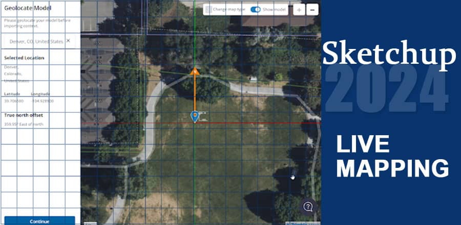
SketchUp 2024 offers significantly improved geolocation tools, making it easier than ever to position models accurately in real-world coordinates. These tools allow users to import high-resolution aerial imagery and terrain data directly into their projects. With these enhancements, designers can create contextually accurate models that reflect the true environment in which their projects will exist.
These geolocation capabilities are particularly beneficial for landscape architects and urban planners who need to ensure their designs fit seamlessly into existing landscapes. By working with precise location data, they can avoid costly errors and make more informed design decisions.
Seamless Integration with GIS and CAD Software
Another major advancement in SketchUp 2024 is its improved interoperability with other GIS and CAD software. Users can now easily import and export data between SketchUp and popular GIS platforms such as ArcGIS and QGIS. This integration ensures that all project stakeholders can work with the same datasets, facilitating better collaboration and communication.
For instance, a city planner using ArcGIS can export a detailed map to SketchUp, where an architect can then create a 3D model of a proposed building. Once the design is complete, the 3D model can be imported back into ArcGIS for further analysis and presentation.
Live Mapping in Action: Case Studies
Urban Planning in Smart Cities
Smart cities around the world are leveraging SketchUp 2024’s live mapping capabilities to enhance urban planning. In one notable case, a city in Europe used SketchUp to create a dynamic 3D map that integrated real-time traffic and pollution data. This map helped planners design more efficient transportation routes and implement green spaces that improved air quality.
Disaster Response and Management
In disaster-prone areas, real-time mapping is critical for effective response and management. SketchUp 2024 has been employed by emergency services to create live maps that track the spread of wildfires, floods, and other natural disasters. These maps provide real-time data to responders, enabling them to allocate resources more effectively and save lives.
Conclusion
SketchUp 2024 is revolutionizing the field of live mapping, offering powerful tools that integrate real-time data, enhance geolocation accuracy, and ensure seamless interoperability with other GIS and CAD software. These features make it an indispensable tool for professionals in architecture, urban planning, and environmental engineering. As cities and technologies continue to evolve, SketchUp 2024 stands out as a critical asset in the pursuit of smarter, more responsive, and sustainable design and planning solutions.
By harnessing the capabilities of SketchUp 2024, designers and planners can create more accurate, informed, and impactful projects that meet the demands of today’s dynamic environments.


