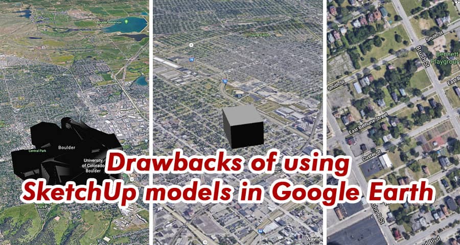
In the realm of 3D modeling and mapping, SketchUp and Google Earth stand as titans, offering users the ability to visualize and create stunning digital landscapes. However, while the integration of SketchUp models into Google Earth may seem like a seamless marriage of technologies, there are significant drawbacks that users must consider.
Limited Realism and Detail
One of the primary drawbacks of utilizing SketchUp models in Google Earth is the inherent limitation in realism and detail. While SketchUp excels in creating basic geometric shapes and structures, it often falls short when it comes to accurately representing real-world features and textures. This limitation becomes particularly pronounced when attempting to render complex landscapes or intricate architectural designs.
Compatibility Issues
Another key drawback is the potential for compatibility issues between SketchUp models and Google Earth. Despite efforts to streamline the integration process, users frequently encounter difficulties when attempting to import SketchUp models into Google Earth. These issues can range from scaling discrepancies to texture mapping errors, resulting in a frustrating user experience and diminished visual quality.
Performance Concerns
In addition to compatibility issues, the use of SketchUp models in Google Earth can also raise concerns regarding performance. Rendering detailed 3D models within a web-based platform like Google Earth can strain system resources, leading to slower load times and decreased overall performance. This becomes especially problematic for users with older hardware or limited internet connectivity, as it can significantly impede their ability to interact with the virtual environment effectively.
Lack of Collaboration Features
Furthermore, the lack of robust collaboration features poses a significant drawback for users seeking to collaborate on projects within Google Earth. While SketchUp offers built-in collaboration tools that allow multiple users to work on a model simultaneously, these features are not fully integrated into Google Earth. As a result, users may find it challenging to collaborate effectively on complex projects or share their creations with others in a meaningful way.
Alternatives and Solutions
Despite these drawbacks, there are several alternatives and solutions available to users seeking to create and share 3D models in Google Earth. One option is to utilize third-party plugins and extensions that enhance SketchUp’s capabilities and improve compatibility with Google Earth. Additionally, exploring alternative 3D modeling software that offers tighter integration with Google Earth may also mitigate some of the aforementioned issues.
Exploring Advanced Techniques
To overcome the limitations of using SketchUp models in Google Earth, advanced techniques and strategies can be employed to enhance the overall user experience and maximize the potential of 3D visualization.
- Photorealistic Rendering: One approach is to utilize photorealistic rendering techniques to enhance the visual fidelity of SketchUp models within Google Earth. By leveraging advanced rendering software and techniques, users can achieve lifelike textures, lighting effects, and atmospheric elements, resulting in a more immersive and realistic viewing experience.
- Custom Texture Mapping: Another strategy is to invest time and effort into custom texture mapping for SketchUp models. By meticulously applying high-resolution textures and materials to 3D models, users can significantly enhance their visual quality and realism within Google Earth. This attention to detail can elevate the overall presentation of virtual landscapes and architectural designs, providing viewers with a more accurate depiction of real-world environments.
- Optimization for Web-Based Platforms: To address performance concerns, optimizing SketchUp models for web-based platforms like Google Earth is essential. This involves reducing polygon counts, simplifying geometry, and optimizing texture sizes to ensure smooth performance and fast load times. By prioritizing optimization techniques, users can ensure that their 3D models remain accessible and responsive across a wide range of devices and internet connections.
- Integration with Geographic Data: Integrating SketchUp models with geographic data layers can further enhance their utility within Google Earth. By overlaying terrain, satellite imagery, and other geospatial data onto SketchUp models, users can create rich, contextually relevant visualizations that convey valuable information and insights. This integration enables users to explore and analyze spatial relationships within a virtual environment, making it a powerful tool for urban planning, environmental modeling, and geographic analysis.
Conclusion
In conclusion, while the integration of SketchUp models into Google Earth offers users a powerful tool for visualizing and creating 3D landscapes, it is not without its drawbacks. From limited realism and compatibility issues to performance concerns and a lack of collaboration features, users must carefully consider these factors before incorporating SketchUp models into their Google Earth projects. By exploring alternative solutions and leveraging third-party tools, users can mitigate these drawbacks and unlock the full potential of 3D modeling and mapping in Google Earth.


